![[AUTO] Falcon 9 Block 5 | SWOT (Surface Water and Ocean Topography) - image](/media?u=https%3A%2F%2Fthespacedevs-prod.nyc3.digitaloceanspaces.com%2Fmedia%2Fimages%2Ffalcon2520925_image_20221215075439.jpeg&w=1600)
SpaceXFalcon 9 Block 5Space Launch Complex 4E, Vandenberg SFB, CA, USA
SWOT (Surface Water and Ocean Topography)
Launched
December 16, 2022

Summary
SWOT (Surface Water and Ocean Topography) launched on a SpaceX Falcon 9 Block 5 from Space Launch Complex 4E, Vandenberg SFB, CA, USA on December 16, 2022. It was SpaceX's 209th launch, 57th this year and humanity's 6,361st orbital launch attempt. It was the 134th Falcon 9 Block 5 flight and the 56th this year. Booster B1071 flew for the 6th time and landed at Landing Zone 4. The payload was bound for low Earth orbit (LEO). It reached a 863 × 869 km orbit inclined 77.6°. One object from this launch is catalogued.
- Watch
- Vehicle
- Falcon 9 Block 5 · SpaceX
- Booster
- B1071 · flight 6 · Return to Launch Site at Landing Zone 4 · landed35/35 landed here · 71 days after its previous flight, Starlink Group 4-29
- Mission
- Earth Science · Low Earth Orbit (LEO)
- Milestone
- 134th Falcon 9 Block 5 flight · 56th this yearSpaceX's 209th launch57th this yearhumanity's 6,361st orbital launch attempt179th orbital launch attempt this year
Webcast
Flight preview
Simulate in Flight ClubOrbit: as tracked
SWOT · NORAD 54754 · 2022-173 · Space-Track
Show the numbers for orbit elements
- Object
- TBA - TO BE ASSIGNED
- Object ID
- 2022-173A
- Epoch
- 2022-12-16 15:10:31 UTC
- Mean motion
- 14.10243039 rev/day
- Eccentricity
- 0.0004052
- Inclination
- 77.5972°
- Ascending node
- 325.9034°
- Arg. of perigee
- 21.4692°
- Mean anomaly
- 110.3072°
- Element set
- 999
- Rev at epoch
- 1
- B*
- 0
Perigee, apogee and period are Kepler figures from the catalogued mean elements, not a propagated state. Published orbit: LEO. Ascent drawn from padside's representative profile. Booster return drawn from padside's representative arc.
Catalogued objects
1 catalogued: 1 payload; 1 still in orbit
- SWOT · NORAD 54754 · in orbit
Data from J. McDowell, planet4589.org
About this launch
Satellite altimeter jointly developed by NASA and CNES, the French space agency, in partnership with the Canadian Space Agency (CSA) and UK Space Agency (UKSA) designed to make the first global survey of the Earth's surface water, to observe the fine details of the ocean surface topography, and to measure how terrestrial surface water bodies change over time.
Pad
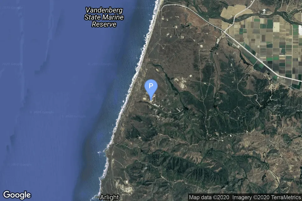
Space Launch Complex 4E, Vandenberg SFB, CA, USA
99th launch from Space Launch Complex 4E, 12th this year · 708th from Vandenberg SFB, CA, USA
303 launches from this pad · 919 from Vandenberg SFB, CA, USA
49 days after the previous launch from this pad
Updates
Good deployment and AOS confirmed, successful launch
Show 9 earlier updates
Liftoff
SwGustav · 12/16/2022 · source
Coverage live
SwGustav · 12/16/2022 · source
NET December 16
Cosmic_Penguin · 12/15/2022 · source
Weather 100%
Nosu · 12/14/2022 · source
Launch date confirmed.
Cosmic_Penguin · 11/30/2022 · source
NET Dec 12
SwGustav · 11/8/2022 · source
Adding approximate launch time
Nosu · 10/14/2022 · source
New launch date
Cosmic_Penguin · 8/25/2022 · source
NET November 15
Nosu · 3/25/2022 · source
Questions
When did SWOT (Surface Water and Ocean Topography) launch?
SWOT (Surface Water and Ocean Topography) launched on December 16, 2022. The time is known to the hour, not the minute.
Where can I watch SWOT (Surface Water and Ocean Topography)?
Coverage: Launch of the International SWOT (Surface Water and Ocean Topography) Mission (NASA Broadcast). Watch the replay
What rocket launched SWOT (Surface Water and Ocean Topography)?
Falcon 9 Block 5, flown by SpaceX. Falcon 9 Block 5 spec sheet
Where did SWOT (Surface Water and Ocean Topography) launch from?
Space Launch Complex 4E, Vandenberg SFB, CA, USA.
Did the booster land?
Booster B1071 flew for the 6th time and landed at Landing Zone 4.
What orbit did SWOT (Surface Water and Ocean Topography) reach?
It reached a 863 × 869 km orbit inclined 77.6°.
How many satellites did SWOT (Surface Water and Ocean Topography) launch?
1 payload from this launch is catalogued, still in orbit (Data from J. McDowell, planet4589.org).